
What Is An Inversion?
National Weather Service
Little Rock, Arkansas

From the National Weather Service Glossary:
A temperature inversion is a layer in the atmosphere
in which air temperature increases with height. An
inversion is present in the lower part of a cap.
The cap is a layer of relatively warm air aloft (above
the inversion). Air parcels rising into this layer
become cooler than the surrounding environment,
which inhibits their ability to ascend.
Temperature Inversion
(The What)

Note: Graphic is from the University of Missouri.
Temperature Inversion
(The What)

Air near the ground cools more quickly than air aloft.
This is most likely when the sky is clear and the wind
is light/calm. Cooling will occur the most readily in
low places (such as valleys sheltered from the wind).
Temperature Inversion
(The Why)

This often happens in the late afternoon/early
evening (before sunset) and lingers into the next
morning (after sunrise) for a few hours.
Temperature Inversion
(The When)

Since warm air rises, air under the inversion cannot
escape because it is cooler than farther aloft. Smoke
and pollution get trapped.
Temperature Inversion
(The Problem)

Note: Edited graphic from the University of Missouri.
Temperature Inversion
(The Problem)

Note: Graphic is from the University of Missouri.
Temperature Inversion
(The Signs)

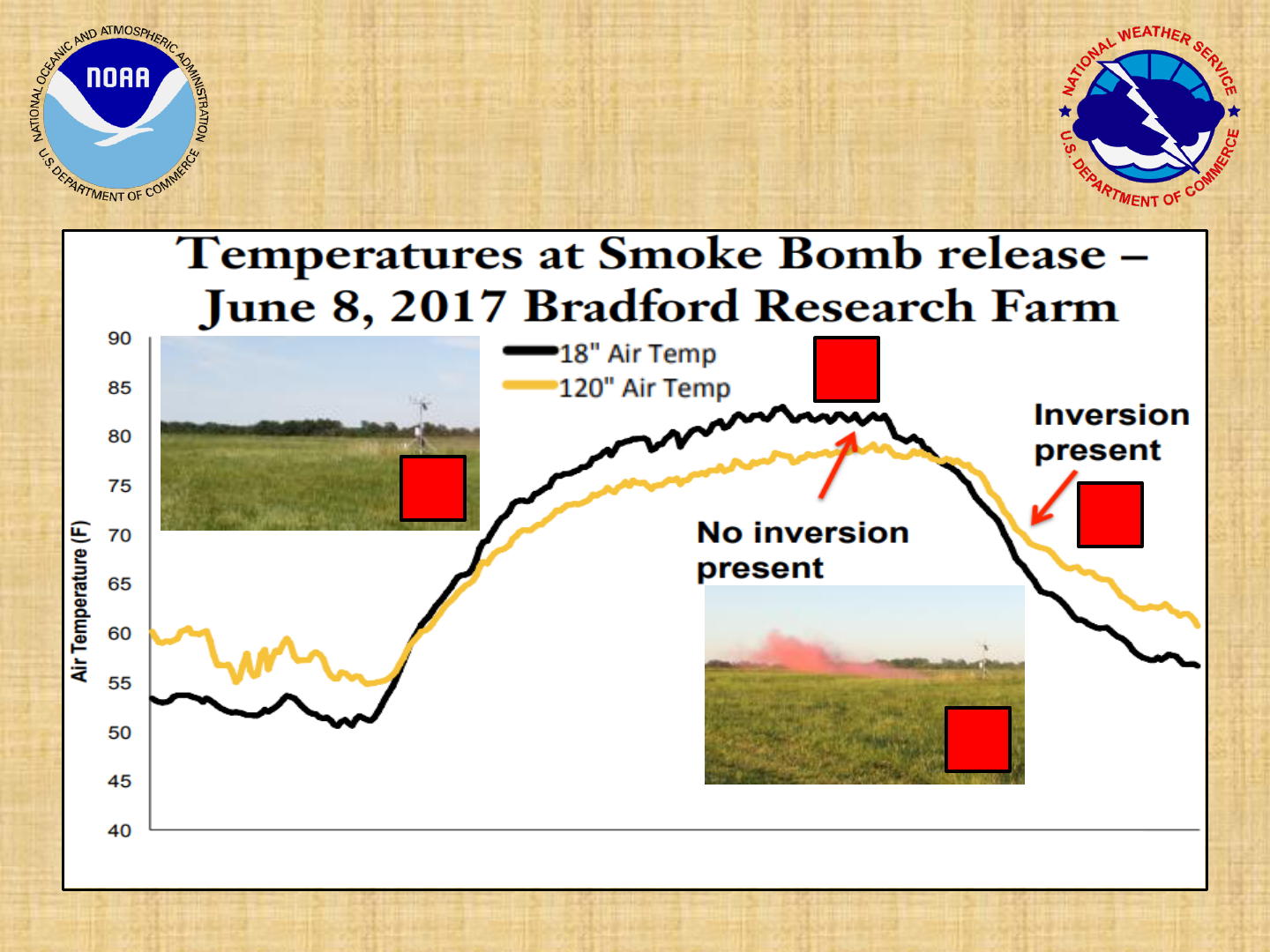
The University of Missouri conducted an experiment
with smoke bombs at a research farm in June, 2017.
At 400 pm CDT, red smoke dispersed within a
minute, indicating no inversion. A minute after a 730
pm CDT release, an inversion had set up and red
smoke hovered along the ground.
Temperature Inversion
(The Demonstration)
Temperature Inversion
(The Demonstration)
Note: Research and graphic from the University of Missouri.
3 am
6 am
9 am
12 pm
12 am
3 pm
6 pm
9 pm
50 seconds after
4 pm release
(no red smoke)
50 seconds after
730 pm release
(red smoke)
1
1
2
2
